 vesseltracker.com
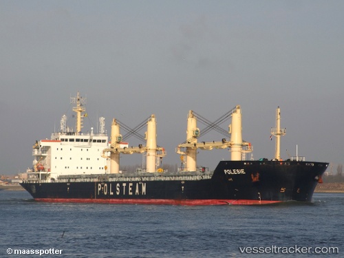
Vessel Polesie IMO: 9488097, MMSI: 311018000 Bulk Carrier
UTC, 53.74588, 4.91152, course: 17, speed: 12
UTC, 54.01747, 5.09690, course: 19, speed: 11.6
2026-02-11 03:55:25 UTC, 54.47418, 5.29627, course: 15, speed: 11.1
Live AIS position:
UTC. 58 nm NW of Town Quays/Drogheda),
updated 2026-02-11 03:55:25 UTC.
Find the position of the vessel Polesie on the map. The latter are known coordinates and path.
marine traffic ship tracker show on live map
The current position of vessel Polesie is 54.47418 lat / 5.29627 lng. Updated: 2026-02-11 03:55:25 UTCCurrently sailing under the flag of Bahamas
Polesie built in 2009 year
Deadweight:
38069 tDetails:
Last coordinates of the vessel:
UTC, 53.35163, 4.66268, course: 21, speed: 13UTC, 53.74588, 4.91152, course: 17, speed: 12
UTC, 54.01747, 5.09690, course: 19, speed: 11.6
2026-02-11 03:55:25 UTC, 54.47418, 5.29627, course: 15, speed: 11.1