 vesseltracker.com
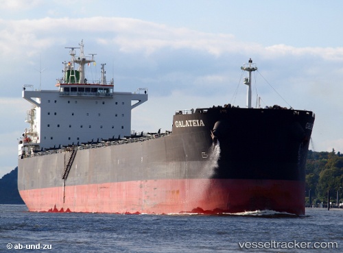
Vessel Galateia IMO: 9597783, MMSI: 311053200 Bulk Carrier
UTC, -28.95297, 32.12699, course: -1, speed: 0.4
UTC, -28.95057, 32.13085, course: -1, speed: 0.4
2026-03-01 20:07:04 UTC, -28.94869, 32.12973, course: -1, speed: 0
Live AIS position:
UTC. Near Richards Bay),
updated 2026-03-01 20:07:04 UTC.
Find the position of the vessel Galateia on the map. The latter are known coordinates and path.
marine traffic ship tracker show on live map
The current position of vessel Galateia is -28.94869 lat / 32.12973 lng. Updated: 2026-03-01 20:07:04 UTCDetails:
Last coordinates of the vessel:
UTC, -28.95279, 32.12598, course: -1, speed: 0.6UTC, -28.95297, 32.12699, course: -1, speed: 0.4
UTC, -28.95057, 32.13085, course: -1, speed: 0.4
2026-03-01 20:07:04 UTC, -28.94869, 32.12973, course: -1, speed: 0