 vesseltracker.com
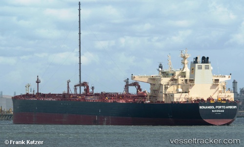
Vessel Sonangol Portoamboi IMO: 9575577, MMSI: 311066300 Crude Oil Tanker
UTC, 28.87024, 48.91758, course: 64, speed: 12.2
UTC, 28.86033, 49.34090, course: 94, speed: 11.5
2026-02-22 09:59:50 UTC, 28.61231, 49.79143, course: 139, speed: 12
Live AIS position:
UTC. 31 nm SE of Soroosh (Cyrus) Terminal),
updated 2026-02-22 09:59:50 UTC.
Find the position of the vessel Sonangol Portoamboi on the map. The latter are known coordinates and path.
marine traffic ship tracker show on live map
The current position of vessel Sonangol Portoamboi is 28.61231 lat / 49.79143 lng. Updated: 2026-02-22 09:59:50 UTCCurrently sailing under the flag of Bahamas
Sonangol Portoamboi built in 2012 year
Deadweight:
157639 tDetails:
Last coordinates of the vessel:
UTC, 28.78302, 48.61869, course: 89, speed: 12UTC, 28.87024, 48.91758, course: 64, speed: 12.2
UTC, 28.86033, 49.34090, course: 94, speed: 11.5
2026-02-22 09:59:50 UTC, 28.61231, 49.79143, course: 139, speed: 12