 vesseltracker.com
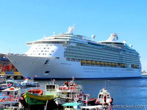
Vessel Mariner Of The Seas IMO: 9227510, MMSI: 311493000 Cruise Ship
UTC, 28.68333, -93.62833, course: -1, speed: 20
UTC, 28.33500, -93.09167, course: -1, speed: 21
2026-01-20 04:22:51 UTC, 28.23423, -92.92913, course: 125, speed: 20.9
Live AIS position:
UTC. 92 nm S of Grand Chenier),
updated 2026-01-20 04:22:51 UTC.
Find the position of the vessel Mariner Of The Seas on the map. The latter are known coordinates and path.
marine traffic ship tracker show on live map
The current position of vessel Mariner Of The Seas is 28.23423 lat / -92.92913 lng. Updated: 2026-01-20 04:22:51 UTCCurrently sailing under the flag of Bahamas
Mariner Of The Seas built in 2003 year
Deadweight:
9616 tDetails:
Last coordinates of the vessel:
UTC, 29.11938, -94.37863, course: 115, speed: 17.4UTC, 28.68333, -93.62833, course: -1, speed: 20
UTC, 28.33500, -93.09167, course: -1, speed: 21
2026-01-20 04:22:51 UTC, 28.23423, -92.92913, course: 125, speed: 20.9