 vesseltracker.com
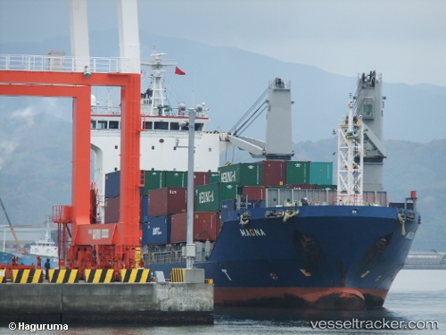
Vessel Magna IMO: 9296468, MMSI: 311703000 Container Ship
UTC, 34.15850, 130.59427, course: 122, speed: 12.1
UTC, 34.03883, 130.85657, course: 309, speed: 0.3
2026-02-01 14:01:08 UTC, 34.03897, 130.85669, course: 298, speed: 0.1
Live AIS position:
UTC. Near KITAKYUSHU),
updated 2026-02-01 14:01:08 UTC.
Find the position of the vessel Magna on the map. The latter are known coordinates and path.
marine traffic ship tracker show on live map
The current position of vessel Magna is 34.03897 lat / 130.85669 lng. Updated: 2026-02-01 14:01:08 UTCCurrently sailing under the flag of Bahamas
Magna built in 2004 year
Deadweight:
6913 tDetails:
Last coordinates of the vessel:
UTC, 34.31167, 130.31667, course: -1, speed: 12UTC, 34.15850, 130.59427, course: 122, speed: 12.1
UTC, 34.03883, 130.85657, course: 309, speed: 0.3
2026-02-01 14:01:08 UTC, 34.03897, 130.85669, course: 298, speed: 0.1