 vesseltracker.com
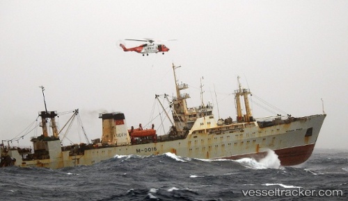
Vessel Priboy IMO: 8033053, MMSI: 312004000 Fishing Vessel
UTC, 36.60703, 35.92665, course: 227, speed: 10.7
UTC, 36.31806, 35.51932, course: 214, speed: 10.2
2026-02-23 01:19:43 UTC, 36.18333, 35.36667, course: -1, speed: 10
Live AIS position:
UTC. 22 nm NW of Brummana),
updated 2026-02-23 01:19:43 UTC.
Find the position of the vessel Priboy on the map. The latter are known coordinates and path.
marine traffic ship tracker show on live map
The current position of vessel Priboy is 36.18333 lat / 35.36667 lng. Updated: 2026-02-23 01:19:43 UTCCurrently sailing under the flag of
Priboy built in 0 year
Deadweight:
0 tDetails:
Last coordinates of the vessel:
UTC, 36.72817, 36.19734, course: 54, speed: 0UTC, 36.60703, 35.92665, course: 227, speed: 10.7
UTC, 36.31806, 35.51932, course: 214, speed: 10.2
2026-02-23 01:19:43 UTC, 36.18333, 35.36667, course: -1, speed: 10