 vesseltracker.com
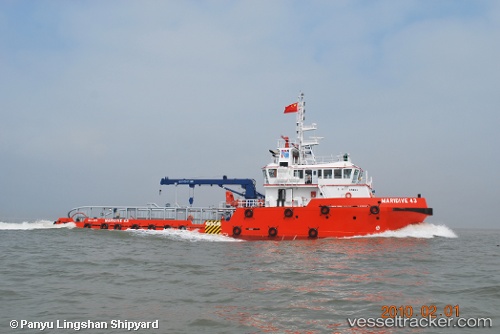
Vessel Maridive 43 IMO: 9559547, MMSI: 312631000 Offshore Tug Supply Ship
UTC, 31.17546, 29.87000, course: 58, speed: 0
UTC, 31.17545, 29.87007, course: 61, speed: 0
2026-02-13 13:58:23 UTC, 31.17542, 29.87003, course: 61, speed: 0
Live AIS position:
UTC. Near Alexandria),
updated 2026-02-13 13:58:23 UTC.
Find the position of the vessel Maridive 43 on the map. The latter are known coordinates and path.
marine traffic ship tracker show on live map
The current position of vessel Maridive 43 is 31.17542 lat / 29.87003 lng. Updated: 2026-02-13 13:58:23 UTCDetails:
Last coordinates of the vessel:
UTC, 31.17780, 29.87039, course: 207, speed: 3.3UTC, 31.17546, 29.87000, course: 58, speed: 0
UTC, 31.17545, 29.87007, course: 61, speed: 0
2026-02-13 13:58:23 UTC, 31.17542, 29.87003, course: 61, speed: 0