 vesseltracker.com
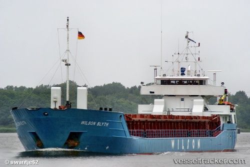
Vessel WILSON BLYTH IMO: 9124419, MMSI: 314544000 General Cargo Ship
UTC, 57.34686, 8.41272, course: 207, speed: 7
UTC, 57.18646, 8.25948, course: 207, speed: 7.2
2026-02-26 16:31:32 UTC, 56.85830, 7.90489, course: 206, speed: 7.1
Live AIS position:
UTC. 14 nm NW of Thyborøn),
updated 2026-02-26 16:31:32 UTC.
Find the position of the vessel WILSON BLYTH on the map. The latter are known coordinates and path.
marine traffic ship tracker show on live map
The current position of vessel WILSON BLYTH is 56.85830 lat / 7.90489 lng. Updated: 2026-02-26 16:31:32 UTCCurrently sailing under the flag of Barbados
WILSON BLYTH built in 1995 year
Deadweight:
3713 tDetails:
Last coordinates of the vessel:
UTC, 57.55231, 8.60584, course: 220, speed: 7.4UTC, 57.34686, 8.41272, course: 207, speed: 7
UTC, 57.18646, 8.25948, course: 207, speed: 7.2
2026-02-26 16:31:32 UTC, 56.85830, 7.90489, course: 206, speed: 7.1