 vesseltracker.com
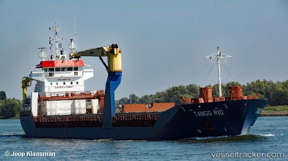
Vessel TANGO RIO IMO: 9205718, MMSI: 314751000 General Cargo
UTC, 40.82743, 29.23251, course: 337, speed: 0
UTC, 40.82733, 29.23140, course: -1, speed: 0.1
2026-02-25 16:07:28 UTC, 40.82777, 29.23040, course: 57, speed: 0
Live AIS position:
UTC. Near TUZLA),
updated 2026-02-25 16:07:28 UTC.
Find the position of the vessel TANGO RIO on the map. The latter are known coordinates and path.
marine traffic ship tracker show on live map
The current position of vessel TANGO RIO is 40.82777 lat / 29.23040 lng. Updated: 2026-02-25 16:07:28 UTCCurrently sailing under the flag of Barbados
Details:
Last coordinates of the vessel:
UTC, 40.82735, 29.23238, course: -1, speed: 0UTC, 40.82743, 29.23251, course: 337, speed: 0
UTC, 40.82733, 29.23140, course: -1, speed: 0.1
2026-02-25 16:07:28 UTC, 40.82777, 29.23040, course: 57, speed: 0