 vesseltracker.com
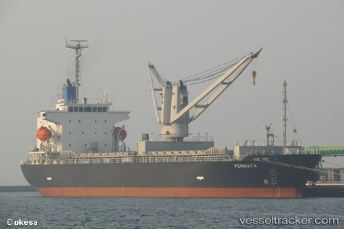
Vessel PERMATA N IMO: 9636137, MMSI: 314881000 General Cargo
UTC, 31.16710, 29.86027, course: 227, speed: 0
UTC, 31.16710, 29.86025, course: -1, speed: 0
2026-03-04 23:51:58 UTC, 31.16710, 29.86026, course: 227, speed: 0
Live Vessel PERMATA N Analytics (details, animations, etc.)
Live AIS position: UTC. Near Alexandria), updated 2026-03-04 23:51:58 UTC.Find the position of the vessel PERMATA N on the map. The latter are known coordinates and path.
marine traffic ship tracker show on live map
The current position of vessel PERMATA N is 31.16710 lat / 29.86026 lng. Updated: 2026-03-04 23:51:58 UTCCurrently sailing under the flag of Barbados
Details:
Last coordinates of the vessel:
UTC, 31.16709, 29.86028, course: 227, speed: 0UTC, 31.16710, 29.86027, course: 227, speed: 0
UTC, 31.16710, 29.86025, course: -1, speed: 0
2026-03-04 23:51:58 UTC, 31.16710, 29.86026, course: 227, speed: 0