 vesseltracker.com
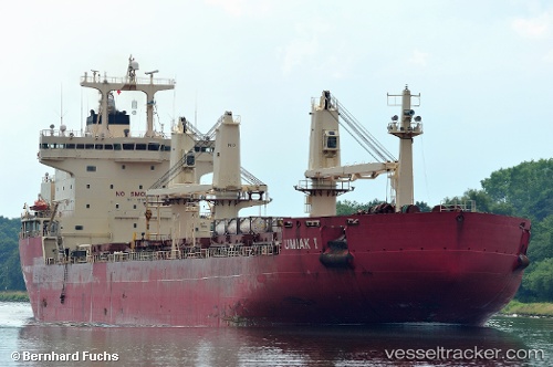
Vessel Umiak I IMO: 9334715, MMSI: 316013340 Bulk Carrier
UTC, 47.42103, -53.82624, course: 59, speed: 0
UTC, 47.42103, -53.82624, course: 59, speed: 0
2026-03-04 06:20:35 UTC, 47.42103, -53.82624, course: 59, speed: 0
Live Vessel Umiak I Analytics (details, animations, etc.)
Live AIS position: UTC. Near Mount Arlington Heights), updated 2026-03-04 06:20:35 UTC.Find the position of the vessel Umiak I on the map. The latter are known coordinates and path.
marine traffic ship tracker show on live map
The current position of vessel Umiak I is 47.42103 lat / -53.82624 lng. Updated: 2026-03-04 06:20:35 UTCDetails:
Last coordinates of the vessel:
UTC, 47.42103, -53.82623, course: 59, speed: 0UTC, 47.42103, -53.82624, course: 59, speed: 0
UTC, 47.42103, -53.82624, course: 59, speed: 0
2026-03-04 06:20:35 UTC, 47.42103, -53.82624, course: 59, speed: 0