 vesseltracker.com
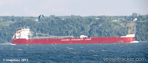
Vessel Whitefish Bay IMO: 9639880, MMSI: 316023341 Self Discharging Bulk Carrier
UTC, 42.98409, -82.41089, course: 272, speed: 0
UTC, 42.98409, -82.41089, course: 272, speed: 0
2026-01-28 13:32:03 UTC, 42.98410, -82.41089, course: 272, speed: 0
Live AIS position:
UTC. Near Port Huron),
updated 2026-01-28 13:32:03 UTC.
Find the position of the vessel Whitefish Bay on the map. The latter are known coordinates and path.
marine traffic ship tracker show on live map
The current position of vessel Whitefish Bay is 42.98410 lat / -82.41089 lng. Updated: 2026-01-28 13:32:03 UTCCurrently sailing under the flag of Canada
Whitefish Bay built in 2013 year
Deadweight:
37690 tDetails:
Last coordinates of the vessel:
UTC, 42.98409, -82.41089, course: 272, speed: 0UTC, 42.98409, -82.41089, course: 272, speed: 0
UTC, 42.98409, -82.41089, course: 272, speed: 0
2026-01-28 13:32:03 UTC, 42.98410, -82.41089, course: 272, speed: 0