 vesseltracker.com
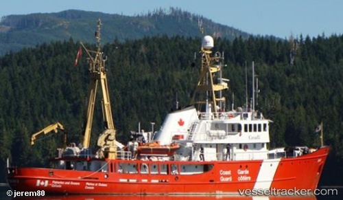
Vessel Tanu IMO: 6817754, MMSI: 316091000 Fishing Support Vessel
UTC, 54.57247, -130.41927, course: 159, speed: 0.1
UTC, 54.57258, -130.41924, course: 173, speed: 0
2026-02-03 02:21:43 UTC, 54.57240, -130.41966, course: 92, speed: 0
Live AIS position:
UTC. 16 nm N of Prince Rupert),
updated 2026-02-03 02:21:43 UTC.
Find the position of the vessel Tanu on the map. The latter are known coordinates and path.
marine traffic ship tracker show on live map
The current position of vessel Tanu is 54.57240 lat / -130.41966 lng. Updated: 2026-02-03 02:21:43 UTCDetails:
Last coordinates of the vessel:
UTC, 54.53280, -130.55676, course: 21, speed: 12.6UTC, 54.57247, -130.41927, course: 159, speed: 0.1
UTC, 54.57258, -130.41924, course: 173, speed: 0
2026-02-03 02:21:43 UTC, 54.57240, -130.41966, course: 92, speed: 0