 vesseltracker.com
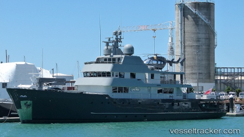
Vessel Plan B IMO: 1007914, MMSI: 319075000 Yacht
UTC, -27.86820, 153.33594, course: 95, speed: 0
UTC, -27.86813, 153.33604, course: 95, speed: 0
2026-02-24 22:05:27 UTC, -27.86845, 153.33632, course: 95, speed: 0
Live AIS position:
UTC. Near HOPE ISLAND),
updated 2026-02-24 22:05:27 UTC.
Find the position of the vessel Plan B on the map. The latter are known coordinates and path.
marine traffic ship tracker show on live map
The current position of vessel Plan B is -27.86845 lat / 153.33632 lng. Updated: 2026-02-24 22:05:27 UTCCurrently sailing under the flag of Cayman Is
Plan B built in 1973 year
Deadweight:
850 tDetails:
Last coordinates of the vessel:
UTC, -27.86846, 153.33617, course: 95, speed: 0UTC, -27.86820, 153.33594, course: 95, speed: 0
UTC, -27.86813, 153.33604, course: 95, speed: 0
2026-02-24 22:05:27 UTC, -27.86845, 153.33632, course: 95, speed: 0