 vesseltracker.com
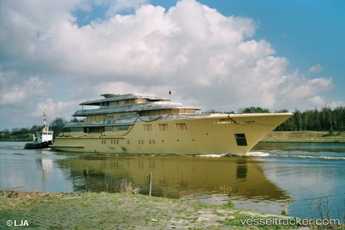
Vessel DEJA TOO IMO: 1007457, MMSI: 319216200 Houseboat
UTC, 23.49453, -75.71801, course: 305, speed: 6.6
UTC, 23.50790, -75.74650, course: 113, speed: 0.1
2026-02-25 19:38:15 UTC, 23.50667, -75.74500, course: -1, speed: 0
Live AIS position:
UTC. Near Great Exuma Island),
updated 2026-02-25 19:38:15 UTC.
Find the position of the vessel DEJA TOO on the map. The latter are known coordinates and path.
marine traffic ship tracker show on live map
The current position of vessel DEJA TOO is 23.50667 lat / -75.74500 lng. Updated: 2026-02-25 19:38:15 UTCCurrently sailing under the flag of Cayman Islands
DEJA TOO built in 2003 year
Deadweight:
134 tDetails:
Last coordinates of the vessel:
UTC, 23.73500, -75.32167, course: -1, speed: 10UTC, 23.49453, -75.71801, course: 305, speed: 6.6
UTC, 23.50790, -75.74650, course: 113, speed: 0.1
2026-02-25 19:38:15 UTC, 23.50667, -75.74500, course: -1, speed: 0