 vesseltracker.com
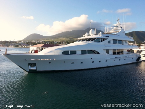
Vessel FORTITUDE IMO: 8653310, MMSI: 319235100 Yacht
UTC, 18.29814, -65.28052, course: 86, speed: 0
UTC, 18.29854, -65.28041, course: 115, speed: 0.4
2026-02-27 15:31:14 UTC, 18.29867, -65.28037, course: 98, speed: 0.7
Live AIS position:
UTC. Near CULEBRA),
updated 2026-02-27 15:31:14 UTC.
Find the position of the vessel FORTITUDE on the map. The latter are known coordinates and path.
marine traffic ship tracker show on live map
The current position of vessel FORTITUDE is 18.29867 lat / -65.28037 lng. Updated: 2026-02-27 15:31:14 UTCCurrently sailing under the flag of Cayman Islands
Details:
Last coordinates of the vessel:
UTC, 18.29814, -65.28052, course: 86, speed: 0UTC, 18.29814, -65.28052, course: 86, speed: 0
UTC, 18.29854, -65.28041, course: 115, speed: 0.4
2026-02-27 15:31:14 UTC, 18.29867, -65.28037, course: 98, speed: 0.7