 vesseltracker.com
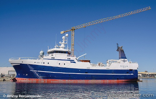
Vessel TASERMIUT IMO: 9263291, MMSI: 331100019 Trawler
UTC, 64.41354, -36.67405, course: 288, speed: 3.3
UTC, 64.40481, -36.64497, course: 95, speed: 12.4
2026-02-25 11:52:37 UTC, 64.41853, -36.81054, course: 90, speed: 4.1
Live AIS position:
UTC. 58 nm E of Isertoq),
updated 2026-02-25 11:52:37 UTC.
Find the position of the vessel TASERMIUT on the map. The latter are known coordinates and path.
marine traffic ship tracker show on live map
The current position of vessel TASERMIUT is 64.41853 lat / -36.81054 lng. Updated: 2026-02-25 11:52:37 UTCCurrently sailing under the flag of Greenland
Details:
Last coordinates of the vessel:
UTC, 64.40981, -36.72118, course: 288, speed: 3.6UTC, 64.41354, -36.67405, course: 288, speed: 3.3
UTC, 64.40481, -36.64497, course: 95, speed: 12.4
2026-02-25 11:52:37 UTC, 64.41853, -36.81054, course: 90, speed: 4.1