 vesseltracker.com
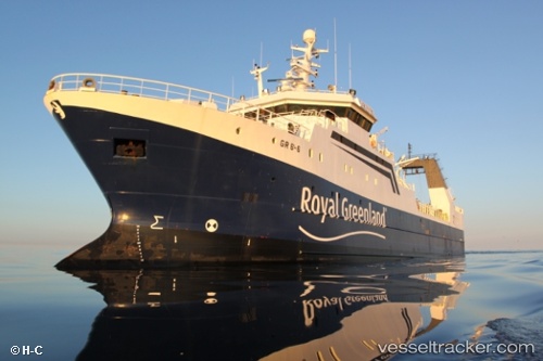
Vessel Akamalik IMO: 9228928, MMSI: 331168000 Fishing Vessel
UTC, 64.16920, -51.72133, course: 208, speed: 0
UTC, 64.17141, -51.72187, course: 30, speed: 0
2026-03-04 14:29:53 UTC, 64.17144, -51.72189, course: 28, speed: 0
Live Vessel Akamalik Analytics (details, animations, etc.)
Live AIS position: UTC. Near Godthab), updated 2026-03-04 14:29:53 UTC.Find the position of the vessel Akamalik on the map. The latter are known coordinates and path.
marine traffic ship tracker show on live map
The current position of vessel Akamalik is 64.17144 lat / -51.72189 lng. Updated: 2026-03-04 14:29:53 UTCCurrently sailing under the flag of Greenland
Akamalik built in 2001 year
Deadweight:
1000 tDetails:
Last coordinates of the vessel:
UTC, 64.16934, -51.72137, course: 206, speed: 0UTC, 64.16920, -51.72133, course: 208, speed: 0
UTC, 64.17141, -51.72187, course: 30, speed: 0
2026-03-04 14:29:53 UTC, 64.17144, -51.72189, course: 28, speed: 0