 vesseltracker.com
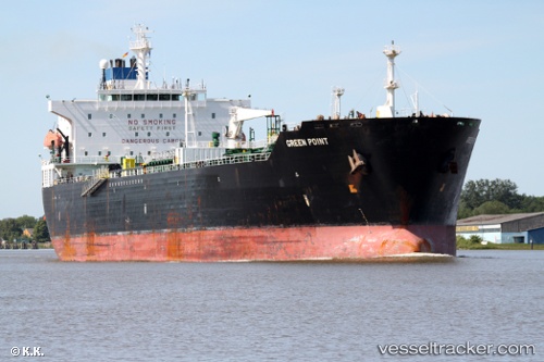
Vessel PURE POINT IMO: 9259886, MMSI: 341058001 Oil Products Tanker
UTC, 29.58273, 48.78960, course: -1, speed: 0.1
UTC, 29.58279, 48.78979, course: -1, speed: 0.2
2026-03-01 21:40:07 UTC, 29.58298, 48.79033, course: -1, speed: 0.1
Live AIS position:
UTC. 10 nm S of Basrah Oil Terminal),
updated 2026-03-01 21:40:07 UTC.
Find the position of the vessel PURE POINT on the map. The latter are known coordinates and path.
marine traffic ship tracker show on live map
The current position of vessel PURE POINT is 29.58298 lat / 48.79033 lng. Updated: 2026-03-01 21:40:07 UTCCurrently sailing under the flag of Saint Kitts and Nevis
Details:
Last coordinates of the vessel:
UTC, 29.58284, 48.78841, course: -1, speed: 0.1UTC, 29.58273, 48.78960, course: -1, speed: 0.1
UTC, 29.58279, 48.78979, course: -1, speed: 0.2
2026-03-01 21:40:07 UTC, 29.58298, 48.79033, course: -1, speed: 0.1