 vesseltracker.com
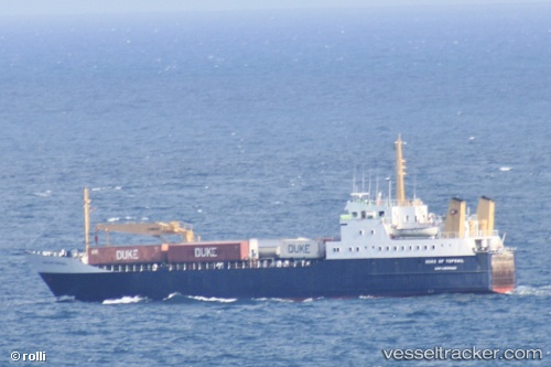
Vessel Duke Of Topsail IMO: 7206770, MMSI: 341295000 Ro Ro Cargo Ship
UTC, 27.44167, -78.92833, course: -1, speed: 11
UTC, 27.41667, -78.59833, course: -1, speed: 12
2026-02-05 08:16:58 UTC, 27.22167, -78.01667, course: -1, speed: 11
Live AIS position:
UTC. 38 nm N of South Riding Point),
updated 2026-02-05 08:16:58 UTC.
Find the position of the vessel Duke Of Topsail on the map. The latter are known coordinates and path.
marine traffic ship tracker show on live map
The current position of vessel Duke Of Topsail is 27.22167 lat / -78.01667 lng. Updated: 2026-02-05 08:16:58 UTCDetails:
Last coordinates of the vessel:
UTC, 27.34667, -79.20500, course: -1, speed: 11UTC, 27.44167, -78.92833, course: -1, speed: 11
UTC, 27.41667, -78.59833, course: -1, speed: 12
2026-02-05 08:16:58 UTC, 27.22167, -78.01667, course: -1, speed: 11