 vesseltracker.com
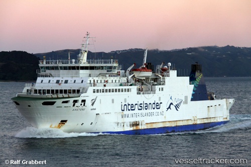
Vessel VEGA IMO: 9174828, MMSI: 341394002 Ro-Ro/Passenger Ship
UTC, -41.16000, 173.27333, course: -1, speed: 0
UTC, -41.16000, 173.27167, course: -1, speed: 0
2026-03-06 03:55:42 UTC, -41.16000, 173.27167, course: -1, speed: 0
Live Vessel VEGA Analytics (details, animations, etc.)
Live AIS position: UTC. Near Nelson), updated 2026-03-06 03:55:42 UTC.Find the position of the vessel VEGA on the map. The latter are known coordinates and path.
marine traffic ship tracker show on live map
The current position of vessel VEGA is -41.16000 lat / 173.27167 lng. Updated: 2026-03-06 03:55:42 UTCCurrently sailing under the flag of Saint Kitts and Nevis
Details:
Last coordinates of the vessel:
UTC, -41.16000, 173.27333, course: -1, speed: 0UTC, -41.16000, 173.27333, course: -1, speed: 0
UTC, -41.16000, 173.27167, course: -1, speed: 0
2026-03-06 03:55:42 UTC, -41.16000, 173.27167, course: -1, speed: 0