 vesseltracker.com
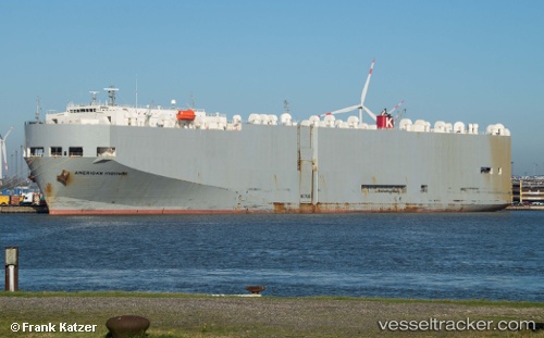
Vessel American Highway IMO: 9205976, MMSI: 351124000 Vehicles Carrier
UTC, 23.19750, -106.41298, course: 200, speed: 0
UTC, 23.19749, -106.41299, course: 200, speed: 0
2026-01-26 11:47:06 UTC, 23.19749, -106.41298, course: 200, speed: 0
Live AIS position:
UTC. Near Mazatlan),
updated 2026-01-26 11:47:06 UTC.
Find the position of the vessel American Highway on the map. The latter are known coordinates and path.
marine traffic ship tracker show on live map
The current position of vessel American Highway is 23.19749 lat / -106.41298 lng. Updated: 2026-01-26 11:47:06 UTCDetails:
Last coordinates of the vessel:
UTC, 23.19749, -106.41300, course: 200, speed: 0UTC, 23.19750, -106.41298, course: 200, speed: 0
UTC, 23.19749, -106.41299, course: 200, speed: 0
2026-01-26 11:47:06 UTC, 23.19749, -106.41298, course: 200, speed: 0