 vesseltracker.com
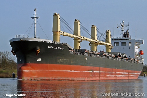
Vessel Meloi IMO: 9392119, MMSI: 351132000 Bulk Carrier
UTC, 29.94697, -90.22113, course: 161, speed: 12.6
UTC, 29.64688, -89.95482, course: 142, speed: 11.7
2026-02-26 21:24:49 UTC, 29.44950, -89.60172, course: -1, speed: 12.1
Live AIS position:
UTC. Near Port Sulphur),
updated 2026-02-26 21:24:49 UTC.
Find the position of the vessel Meloi on the map. The latter are known coordinates and path.
marine traffic ship tracker show on live map
The current position of vessel Meloi is 29.44950 lat / -89.60172 lng. Updated: 2026-02-26 21:24:49 UTCCurrently sailing under the flag of Panama
Meloi built in 2009 year
Deadweight:
33355 tDetails:
Last coordinates of the vessel:
UTC, 30.02428, -90.47307, course: 184, speed: 12.7UTC, 29.94697, -90.22113, course: 161, speed: 12.6
UTC, 29.64688, -89.95482, course: 142, speed: 11.7
2026-02-26 21:24:49 UTC, 29.44950, -89.60172, course: -1, speed: 12.1