 vesseltracker.com
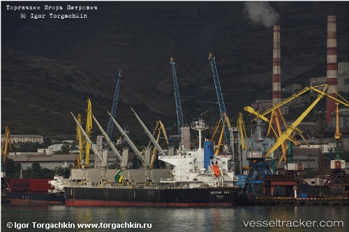
Vessel Serene Sky IMO: 9514353, MMSI: 351224000 Bulk Carrier
UTC, 20.32077, 120.98647, course: 66, speed: 11.2
UTC, 20.60370, 121.34029, course: 52, speed: 12.4
2026-02-16 09:52:54 UTC, 20.85851, 121.61603, course: 35, speed: 13.1
Live AIS position:
UTC. 31 nm NW of Basco),
updated 2026-02-16 09:52:54 UTC.
Find the position of the vessel Serene Sky on the map. The latter are known coordinates and path.
marine traffic ship tracker show on live map
The current position of vessel Serene Sky is 20.85851 lat / 121.61603 lng. Updated: 2026-02-16 09:52:54 UTCCurrently sailing under the flag of Panama
Serene Sky built in 2011 year
Deadweight:
56119 tDetails:
Last coordinates of the vessel:
UTC, 20.00680, 120.67836, course: 37, speed: 11.1UTC, 20.32077, 120.98647, course: 66, speed: 11.2
UTC, 20.60370, 121.34029, course: 52, speed: 12.4
2026-02-16 09:52:54 UTC, 20.85851, 121.61603, course: 35, speed: 13.1