 vesseltracker.com
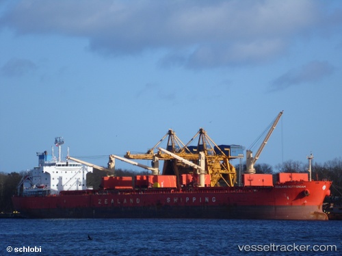
Vessel KARADENIZ S IMO: 9477440, MMSI: 351436000 Bulk Carrier
UTC, -2.11150, 104.96113, course: 342, speed: 0.3
UTC, -2.11152, 104.96116, course: 341, speed: 0
2026-02-07 03:30:50 UTC, -2.11137, 104.96144, course: 332, speed: 0.1
Live AIS position:
UTC. 21 nm SW of Exspan),
updated 2026-02-07 03:30:50 UTC.
Find the position of the vessel KARADENIZ S on the map. The latter are known coordinates and path.
marine traffic ship tracker show on live map
The current position of vessel KARADENIZ S is -2.11137 lat / 104.96144 lng. Updated: 2026-02-07 03:30:50 UTCCurrently sailing under the flag of Panama
KARADENIZ S built in 2012 year
Deadweight:
57157 tDetails:
Last coordinates of the vessel:
UTC, -2.11143, 104.96121, course: 342, speed: 0UTC, -2.11150, 104.96113, course: 342, speed: 0.3
UTC, -2.11152, 104.96116, course: 341, speed: 0
2026-02-07 03:30:50 UTC, -2.11137, 104.96144, course: 332, speed: 0.1