 vesseltracker.com
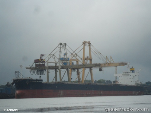
Vessel Lowlands Kamsar IMO: 9461154, MMSI: 351916000 Bulk Carrier
UTC, -15.74333, -11.53500, course: -1, speed: 11
UTC, -16.00436, -11.22269, course: 129, speed: 10.4
2026-03-01 03:35:03 UTC, -16.22421, -10.95860, course: 130, speed: 10.2
Live AIS position:
UTC. 303 nm W of St. Helena Island),
updated 2026-03-01 03:35:03 UTC.
Find the position of the vessel Lowlands Kamsar on the map. The latter are known coordinates and path.
marine traffic ship tracker show on live map
The current position of vessel Lowlands Kamsar is -16.22421 lat / -10.95860 lng. Updated: 2026-03-01 03:35:03 UTCDetails:
Last coordinates of the vessel:
UTC, -15.50938, -11.80698, course: 132, speed: 10.8UTC, -15.74333, -11.53500, course: -1, speed: 11
UTC, -16.00436, -11.22269, course: 129, speed: 10.4
2026-03-01 03:35:03 UTC, -16.22421, -10.95860, course: 130, speed: 10.2