 vesseltracker.com
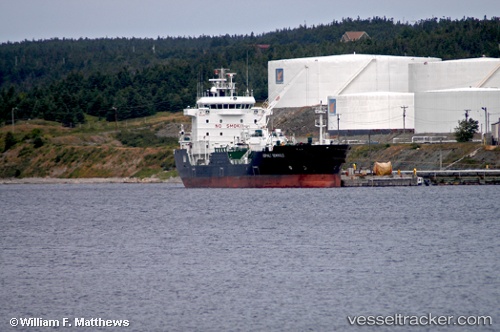
Vessel ASPHALT TERANGA IMO: 9263942, MMSI: 352001408 Asphalt/Bitumen Tanker
UTC, 37.92148, 23.55383, course: 208, speed: 0.1
UTC, 37.92139, 23.55303, course: 179, speed: 0.4
2026-02-01 11:25:59 UTC, 37.92120, 23.55229, course: 147, speed: 0.1
Live AIS position:
UTC. Near Kamaterón),
updated 2026-02-01 11:25:59 UTC.
Find the position of the vessel ASPHALT TERANGA on the map. The latter are known coordinates and path.
marine traffic ship tracker show on live map
The current position of vessel ASPHALT TERANGA is 37.92120 lat / 23.55229 lng. Updated: 2026-02-01 11:25:59 UTCCurrently sailing under the flag of Panama
ASPHALT TERANGA built in 2005 year
Deadweight:
9230 tDetails:
Last coordinates of the vessel:
UTC, 37.92157, 23.55276, course: 185, speed: 0.3UTC, 37.92148, 23.55383, course: 208, speed: 0.1
UTC, 37.92139, 23.55303, course: 179, speed: 0.4
2026-02-01 11:25:59 UTC, 37.92120, 23.55229, course: 147, speed: 0.1