 vesseltracker.com
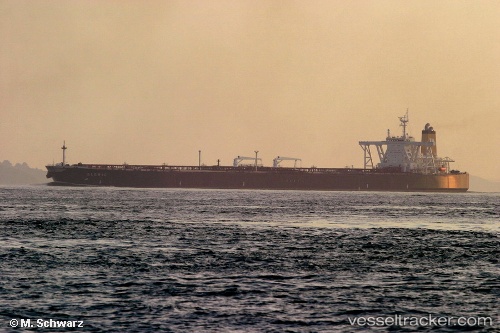
Vessel TEJAS IMO: 9326067, MMSI: 352002323 Tanker
UTC, 35.82647, 122.53503, course: -1, speed: 11.1
UTC, 35.64463, 123.15918, course: -1, speed: 11.6
2026-02-26 19:45:46 UTC, 35.42932, 123.48315, course: -1, speed: 11.5
Live AIS position:
UTC. 96 nm NW of Hongdo),
updated 2026-02-26 19:45:46 UTC.
Find the position of the vessel TEJAS on the map. The latter are known coordinates and path.
marine traffic ship tracker show on live map
The current position of vessel TEJAS is 35.42932 lat / 123.48315 lng. Updated: 2026-02-26 19:45:46 UTCCurrently sailing under the flag of Panama
Details:
Last coordinates of the vessel:
UTC, 35.84012, 122.40268, course: -1, speed: 11UTC, 35.82647, 122.53503, course: -1, speed: 11.1
UTC, 35.64463, 123.15918, course: -1, speed: 11.6
2026-02-26 19:45:46 UTC, 35.42932, 123.48315, course: -1, speed: 11.5