 vesseltracker.com
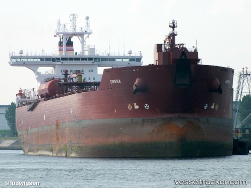
Vessel BLUE LAGOON I IMO: 9248447, MMSI: 352002351 Crude Oil Tanker
UTC, 42.65350, 37.86233, course: -1, speed: 1
UTC, 42.65350, 37.86233, course: -1, speed: 1
2026-02-25 10:40:22 UTC, 42.65350, 37.86233, course: -1, speed: 1
Live AIS position:
UTC. 95 nm N of UNYE),
updated 2026-02-25 10:40:22 UTC.
Find the position of the vessel BLUE LAGOON I on the map. The latter are known coordinates and path.
marine traffic ship tracker show on live map
The current position of vessel BLUE LAGOON I is 42.65350 lat / 37.86233 lng. Updated: 2026-02-25 10:40:22 UTCCurrently sailing under the flag of Panama
BLUE LAGOON I built in 2003 year
Deadweight:
148553 tDetails:
Last coordinates of the vessel:
UTC, 42.34983, 37.63433, course: 350, speed: 2.3UTC, 42.65350, 37.86233, course: -1, speed: 1
UTC, 42.65350, 37.86233, course: -1, speed: 1
2026-02-25 10:40:22 UTC, 42.65350, 37.86233, course: -1, speed: 1