 vesseltracker.com
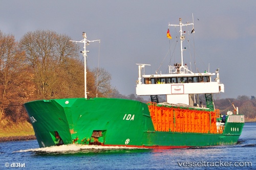
Vessel MARILOU IMO: 8613358, MMSI: 352002491 General Cargo
UTC, 38.37500, 24.03833, course: -1, speed: 0
UTC, 38.37500, 24.03833, course: -1, speed: 0
2026-02-26 09:00:50 UTC, 38.37536, 24.03662, course: -1, speed: 0
Live AIS position:
UTC. Near MILAKI),
updated 2026-02-26 09:00:50 UTC.
Find the position of the vessel MARILOU on the map. The latter are known coordinates and path.
marine traffic ship tracker show on live map
The current position of vessel MARILOU is 38.37536 lat / 24.03662 lng. Updated: 2026-02-26 09:00:50 UTCCurrently sailing under the flag of Panama
Details:
Last coordinates of the vessel:
UTC, 38.37667, 24.03833, course: -1, speed: 0UTC, 38.37500, 24.03833, course: -1, speed: 0
UTC, 38.37500, 24.03833, course: -1, speed: 0
2026-02-26 09:00:50 UTC, 38.37536, 24.03662, course: -1, speed: 0