 vesseltracker.com
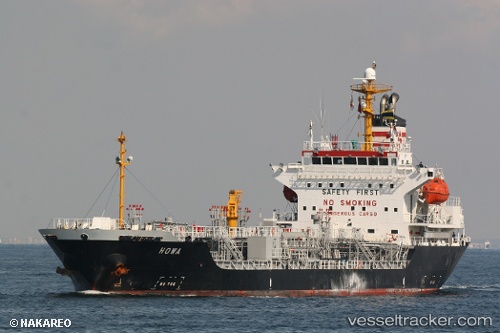
Vessel KS ANGELINA IMO: 9258313, MMSI: 352002894 Tanker
UTC, 1.27603, 104.13007, course: -1, speed: 12.7
UTC, 1.21078, 103.55078, course: 282, speed: 12.2
2026-02-26 13:23:04 UTC, 1.27481, 103.37265, course: -1, speed: 12.3
Live AIS position:
UTC. 11 nm W of TANJUNG PELEPAS),
updated 2026-02-26 13:23:04 UTC.
Find the position of the vessel KS ANGELINA on the map. The latter are known coordinates and path.
marine traffic ship tracker show on live map
The current position of vessel KS ANGELINA is 1.27481 lat / 103.37265 lng. Updated: 2026-02-26 13:23:04 UTCCurrently sailing under the flag of Panama
Details:
Last coordinates of the vessel:
UTC, 1.34257, 104.35953, course: 230, speed: 13.1UTC, 1.27603, 104.13007, course: -1, speed: 12.7
UTC, 1.21078, 103.55078, course: 282, speed: 12.2
2026-02-26 13:23:04 UTC, 1.27481, 103.37265, course: -1, speed: 12.3