 vesseltracker.com
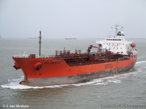
Vessel MARINA AMAN IMO: 9304306, MMSI: 352003343 Oil/Chemical Tanker
UTC, 24.02072, 60.08204, course: 250, speed: 12.2
UTC, 24.02072, 60.08204, course: 250, speed: 12.2
2026-02-28 09:54:57 UTC, 23.97782, 59.98377, course: 250, speed: 11.9
Live AIS position:
UTC. 72 nm NE of Qurayyat),
updated 2026-02-28 09:54:57 UTC.
Find the position of the vessel MARINA AMAN on the map. The latter are known coordinates and path.
marine traffic ship tracker show on live map
The current position of vessel MARINA AMAN is 23.97782 lat / 59.98377 lng. Updated: 2026-02-28 09:54:57 UTCCurrently sailing under the flag of Panama
Details:
Last coordinates of the vessel:
UTC, 24.12238, 60.43239, course: -1, speed: 12.2UTC, 24.02072, 60.08204, course: 250, speed: 12.2
UTC, 24.02072, 60.08204, course: 250, speed: 12.2
2026-02-28 09:54:57 UTC, 23.97782, 59.98377, course: 250, speed: 11.9