 vesseltracker.com
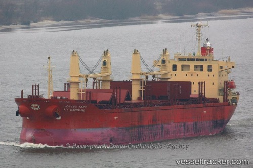
Vessel LADY BABU IMO: 9296303, MMSI: 352004133 Bulk Carrier
UTC, 34.74840, 119.44542, course: 271, speed: 0
UTC, 34.74843, 119.44550, course: 271, speed: 0
2026-02-27 15:23:28 UTC, 34.74845, 119.44550, course: 271, speed: 0.1
Live AIS position:
UTC. Near Lianyungang),
updated 2026-02-27 15:23:28 UTC.
Find the position of the vessel LADY BABU on the map. The latter are known coordinates and path.
marine traffic ship tracker show on live map
The current position of vessel LADY BABU is 34.74845 lat / 119.44550 lng. Updated: 2026-02-27 15:23:28 UTCCurrently sailing under the flag of Panama
Details:
Last coordinates of the vessel:
UTC, 34.74828, 119.44552, course: 271, speed: 0UTC, 34.74840, 119.44542, course: 271, speed: 0
UTC, 34.74843, 119.44550, course: 271, speed: 0
2026-02-27 15:23:28 UTC, 34.74845, 119.44550, course: 271, speed: 0.1