 vesseltracker.com
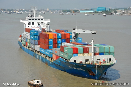
Vessel HT CAMELLIA IMO: 9345910, MMSI: 352005270 Container Ship
UTC, 12.70265, 44.92563, course: 95, speed: 0.4
UTC, 12.70258, 44.92553, course: 71, speed: 0.4
2026-03-10 05:56:42 UTC, 12.70258, 44.92553, course: 71, speed: 0.4
Live Vessel HT CAMELLIA Analytics (details, animations, etc.)
Live AIS position: UTC. Near Little Aden), updated 2026-03-10 05:56:42 UTC.Find the position of the vessel HT CAMELLIA on the map. The latter are known coordinates and path.
marine traffic ship tracker show on live map
The current position of vessel HT CAMELLIA is 12.70258 lat / 44.92553 lng. Updated: 2026-03-10 05:56:42 UTCCurrently sailing under the flag of Panama
Details:
Last coordinates of the vessel:
UTC, 12.70205, 44.92568, course: 63, speed: 0.1UTC, 12.70265, 44.92563, course: 95, speed: 0.4
UTC, 12.70258, 44.92553, course: 71, speed: 0.4
2026-03-10 05:56:42 UTC, 12.70258, 44.92553, course: 71, speed: 0.4