 vesseltracker.com
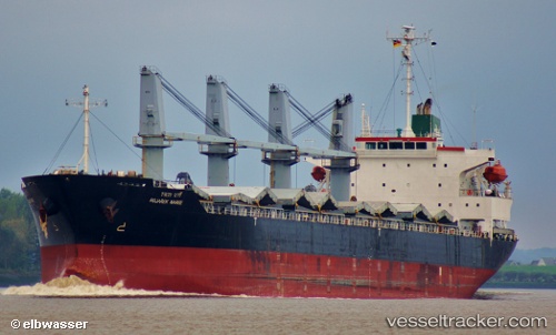
Vessel TATEV IMO: 9288552, MMSI: 352005298 Bulk Carrier
UTC, 48.90937, 140.57828, course: 2, speed: 1.5
UTC, 48.88060, 140.57669, course: 6, speed: 0.8
2026-03-01 02:07:51 UTC, 49.08162, 140.32573, course: 284, speed: 5.3
Live AIS position:
UTC. Near Vanino),
updated 2026-03-01 02:07:51 UTC.
Find the position of the vessel TATEV on the map. The latter are known coordinates and path.
marine traffic ship tracker show on live map
The current position of vessel TATEV is 49.08162 lat / 140.32573 lng. Updated: 2026-03-01 02:07:51 UTCCurrently sailing under the flag of Panama
Details:
Last coordinates of the vessel:
UTC, 48.87737, 140.62720, course: 322, speed: 4.7UTC, 48.90937, 140.57828, course: 2, speed: 1.5
UTC, 48.88060, 140.57669, course: 6, speed: 0.8
2026-03-01 02:07:51 UTC, 49.08162, 140.32573, course: 284, speed: 5.3