 vesseltracker.com
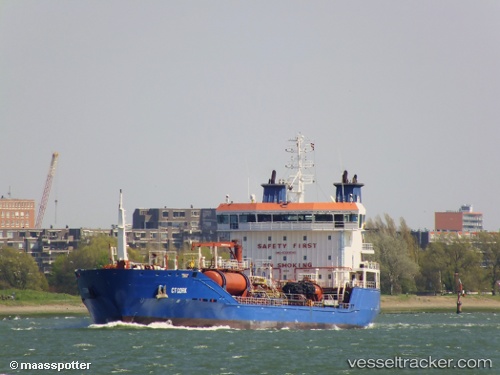
Vessel FRONTERA IMO: 9393060, MMSI: 352005300 Oil/Chemical Tanker
UTC, 11.75383, -63.83267, course: 257, speed: 7.8
UTC, 11.70417, -64.05783, course: 253, speed: 7.7
2026-02-26 10:28:04 UTC, 11.65983, -64.39800, course: 258, speed: 8.3
Live AIS position:
UTC. 46 nm NW of Isla de Margarita),
updated 2026-02-26 10:28:04 UTC.
Find the position of the vessel FRONTERA on the map. The latter are known coordinates and path.
marine traffic ship tracker show on live map
The current position of vessel FRONTERA is 11.65983 lat / -64.39800 lng. Updated: 2026-02-26 10:28:04 UTCCurrently sailing under the flag of Panama
Details:
Last coordinates of the vessel:
UTC, 11.80917, -63.57200, course: 242, speed: 8.2UTC, 11.75383, -63.83267, course: 257, speed: 7.8
UTC, 11.70417, -64.05783, course: 253, speed: 7.7
2026-02-26 10:28:04 UTC, 11.65983, -64.39800, course: 258, speed: 8.3