 vesseltracker.com
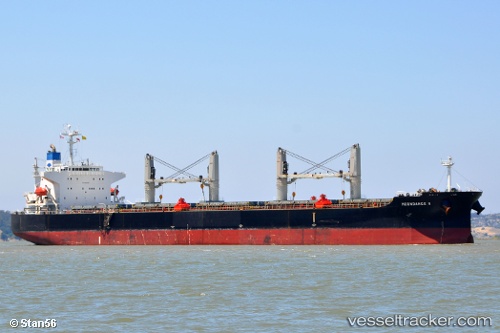
Vessel MAC HOPE IMO: 9316191, MMSI: 352005564 Bulk Carrier
UTC, 29.12599, 49.73839, course: 124, speed: 0
UTC, 29.12596, 49.73830, course: 108, speed: 0.1
2026-03-19 10:14:32 UTC, 29.12438, 49.74142, course: 275, speed: 0
Live Vessel MAC HOPE Analytics (details, animations, etc.)
Live AIS position: UTC. 15 nm E of Soroosh (Cyrus) Terminal), updated 2026-03-19 10:14:32 UTC.Find the position of the vessel MAC HOPE on the map. The latter are known coordinates and path.
marine traffic ship tracker show on live map
The current position of vessel MAC HOPE is 29.12438 lat / 49.74142 lng. Updated: 2026-03-19 10:14:32 UTCCurrently sailing under the flag of Panama
Details:
Last coordinates of the vessel:
UTC, 29.12631, 49.73898, course: 140, speed: 0.1UTC, 29.12599, 49.73839, course: 124, speed: 0
UTC, 29.12596, 49.73830, course: 108, speed: 0.1
2026-03-19 10:14:32 UTC, 29.12438, 49.74142, course: 275, speed: 0