 vesseltracker.com
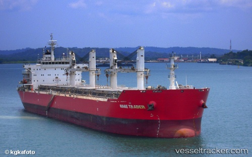
Vessel YING LI IMO: 9567415, MMSI: 352005760 Bulk Carrier
UTC, 5.99500, 92.02833, course: -1, speed: 12
UTC, 5.97667, 91.62667, course: -1, speed: 12
2026-02-28 13:16:32 UTC, 5.97640, 91.43848, course: -1, speed: 12
Live AIS position:
UTC. 229 nm W of LHOKNGA),
updated 2026-02-28 13:16:32 UTC.
Find the position of the vessel YING LI on the map. The latter are known coordinates and path.
marine traffic ship tracker show on live map
The current position of vessel YING LI is 5.97640 lat / 91.43848 lng. Updated: 2026-02-28 13:16:32 UTCCurrently sailing under the flag of Panama
Details:
Last coordinates of the vessel:
UTC, 6.00507, 92.57925, course: -1, speed: 12.2UTC, 5.99500, 92.02833, course: -1, speed: 12
UTC, 5.97667, 91.62667, course: -1, speed: 12
2026-02-28 13:16:32 UTC, 5.97640, 91.43848, course: -1, speed: 12