 vesseltracker.com
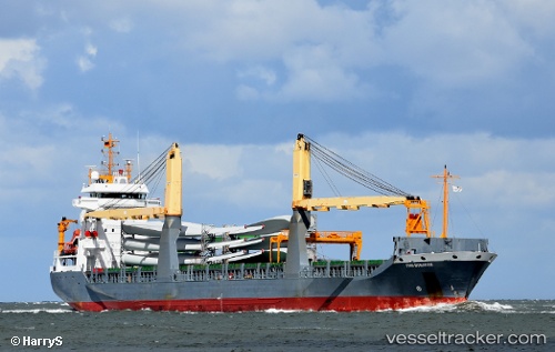
Vessel LADY LAURA IMO: 9321108, MMSI: 352006290 General Cargo
UTC, 36.69844, 13.20855, course: -1, speed: 11.3
UTC, 36.69844, 13.20855, course: -1, speed: 11.3
2026-02-28 06:11:32 UTC, 36.58809, 13.82237, course: -1, speed: 11.6
Live AIS position:
UTC. 31 nm S of Licata),
updated 2026-02-28 06:11:32 UTC.
Find the position of the vessel LADY LAURA on the map. The latter are known coordinates and path.
marine traffic ship tracker show on live map
The current position of vessel LADY LAURA is 36.58809 lat / 13.82237 lng. Updated: 2026-02-28 06:11:32 UTCCurrently sailing under the flag of Panama
Details:
Last coordinates of the vessel:
UTC, 36.76932, 12.86982, course: -1, speed: 11.3UTC, 36.69844, 13.20855, course: -1, speed: 11.3
UTC, 36.69844, 13.20855, course: -1, speed: 11.3
2026-02-28 06:11:32 UTC, 36.58809, 13.82237, course: -1, speed: 11.6