 vesseltracker.com
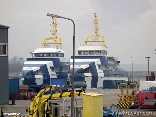
Vessel Astra G IMO: 9648491, MMSI: 352986000 Research Vessel
UTC, 11.14833, -58.26667, course: -1, speed: 7
UTC, 11.09666, -58.20833, course: -1, speed: 3
2026-02-14 21:38:54 UTC, 11.00578, -58.09673, course: 132, speed: 4.3
Live AIS position:
UTC. 146 nm E of Charlotteville),
updated 2026-02-14 21:38:54 UTC.
Find the position of the vessel Astra G on the map. The latter are known coordinates and path.
marine traffic ship tracker show on live map
The current position of vessel Astra G is 11.00578 lat / -58.09673 lng. Updated: 2026-02-14 21:38:54 UTCCurrently sailing under the flag of Panama
Astra G built in 2013 year
Deadweight:
250 tDetails:
Last coordinates of the vessel:
UTC, 11.22667, -58.42833, course: -1, speed: 5UTC, 11.14833, -58.26667, course: -1, speed: 7
UTC, 11.09666, -58.20833, course: -1, speed: 3
2026-02-14 21:38:54 UTC, 11.00578, -58.09673, course: 132, speed: 4.3