 vesseltracker.com
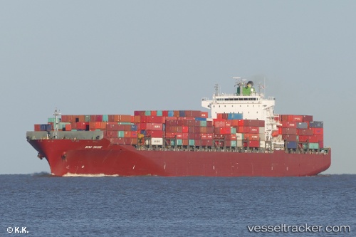
Vessel Sino Bridge IMO: 9292175, MMSI: 353111000 Container Ship
UTC, 32.83858, -79.93287, course: 183, speed: 0
UTC, 32.84010, -79.92902, course: 179, speed: 2.1
2026-02-07 07:54:39 UTC, 32.65092, -79.66262, course: 117, speed: 9.7
Live AIS position:
UTC. Near Isle of Palms),
updated 2026-02-07 07:54:39 UTC.
Find the position of the vessel Sino Bridge on the map. The latter are known coordinates and path.
marine traffic ship tracker show on live map
The current position of vessel Sino Bridge is 32.65092 lat / -79.66262 lng. Updated: 2026-02-07 07:54:39 UTCCurrently sailing under the flag of Panama
Sino Bridge built in 2004 year
Deadweight:
65038 tDetails:
Last coordinates of the vessel:
UTC, 32.83867, -79.93283, course: 183, speed: 0UTC, 32.83858, -79.93287, course: 183, speed: 0
UTC, 32.84010, -79.92902, course: 179, speed: 2.1
2026-02-07 07:54:39 UTC, 32.65092, -79.66262, course: 117, speed: 9.7