 vesseltracker.com
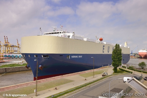
Vessel Morning Cindy IMO: 9633185, MMSI: 353647000 Vehicles Carrier
UTC, 24.98992, 55.07593, course: 47, speed: 0
UTC, 25.08987, 54.97114, course: 318, speed: 11.3
2026-02-08 11:38:58 UTC, 25.63067, 55.11560, course: 64, speed: 18.5
Live AIS position:
UTC. 15 nm S of Abu Musa),
updated 2026-02-08 11:38:58 UTC.
Find the position of the vessel Morning Cindy on the map. The latter are known coordinates and path.
marine traffic ship tracker show on live map
The current position of vessel Morning Cindy is 25.63067 lat / 55.11560 lng. Updated: 2026-02-08 11:38:58 UTCDetails:
Last coordinates of the vessel:
UTC, 24.98991, 55.07591, course: 47, speed: 0UTC, 24.98992, 55.07593, course: 47, speed: 0
UTC, 25.08987, 54.97114, course: 318, speed: 11.3
2026-02-08 11:38:58 UTC, 25.63067, 55.11560, course: 64, speed: 18.5