 vesseltracker.com
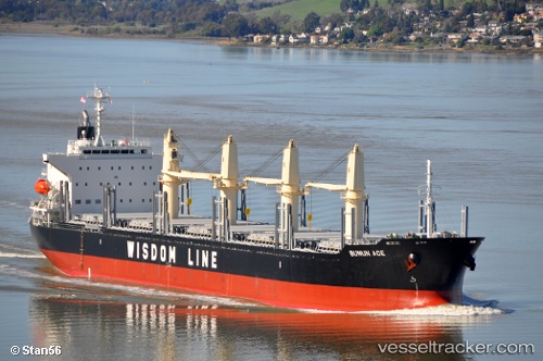
Vessel Bunun Ace IMO: 9628570, MMSI: 354196000 Bulk Carrier
UTC, 34.24895, -7.69892, course: 41, speed: 10.4
UTC, 34.55675, -7.34632, course: 37, speed: 10.6
2026-02-20 01:40:17 UTC, 35.04501, -6.83010, course: 39, speed: 10.7
Live AIS position:
UTC. 29 nm W of Moulay Bou Selham),
updated 2026-02-20 01:40:17 UTC.
Find the position of the vessel Bunun Ace on the map. The latter are known coordinates and path.
marine traffic ship tracker show on live map
The current position of vessel Bunun Ace is 35.04501 lat / -6.83010 lng. Updated: 2026-02-20 01:40:17 UTCDetails:
Last coordinates of the vessel:
UTC, 34.06891, -7.88817, course: 42, speed: 10.2UTC, 34.24895, -7.69892, course: 41, speed: 10.4
UTC, 34.55675, -7.34632, course: 37, speed: 10.6
2026-02-20 01:40:17 UTC, 35.04501, -6.83010, course: 39, speed: 10.7