 vesseltracker.com
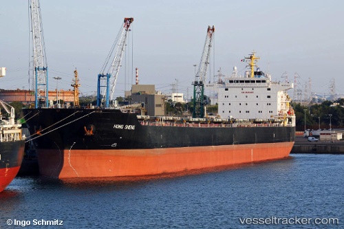
Vessel Hong Sheng IMO: 9563627, MMSI: 354643000 Bulk Carrier
UTC, -30.98475, 37.91123, course: 69, speed: 11.9
UTC, -30.82948, 38.36606, course: 71, speed: 10.8
2026-02-23 08:23:43 UTC, -30.69320, 38.76805, course: 65, speed: 10
Live AIS position:
UTC. 363 nm E of Richards Bay),
updated 2026-02-23 08:23:43 UTC.
Find the position of the vessel Hong Sheng on the map. The latter are known coordinates and path.
marine traffic ship tracker show on live map
The current position of vessel Hong Sheng is -30.69320 lat / 38.76805 lng. Updated: 2026-02-23 08:23:43 UTCDetails:
Last coordinates of the vessel:
UTC, -31.14063, 37.52059, course: 66, speed: 11.2UTC, -30.98475, 37.91123, course: 69, speed: 11.9
UTC, -30.82948, 38.36606, course: 71, speed: 10.8
2026-02-23 08:23:43 UTC, -30.69320, 38.76805, course: 65, speed: 10