 vesseltracker.com
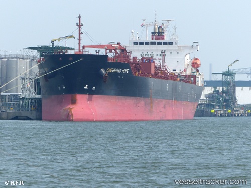
Vessel 'CHEMROAD HOPE' IMO: 9565754, MMSI: 356050000
UTC, 1.19819, 103.68546, course: 356, speed: 0.1
UTC, 1.19843, 103.68494, course: 16, speed: 0.1
2026-02-17 17:56:24 UTC, 1.19901, 103.68417, course: 45, speed: 0.1
Live AIS position:
UTC. Near JURONG ISLAND),
updated 2026-02-17 17:56:24 UTC.
Find the position of the vessel 'CHEMROAD HOPE' on the map. The latter are known coordinates and path.
marine traffic ship tracker show on live map
The current position of vessel 'CHEMROAD HOPE' is 1.19901 lat / 103.68417 lng. Updated: 2026-02-17 17:56:24 UTCDetails:
Last coordinates of the vessel:
UTC, 1.19822, 103.68533, course: 16, speed: 0.1UTC, 1.19819, 103.68546, course: 356, speed: 0.1
UTC, 1.19843, 103.68494, course: 16, speed: 0.1
2026-02-17 17:56:24 UTC, 1.19901, 103.68417, course: 45, speed: 0.1