 vesseltracker.com
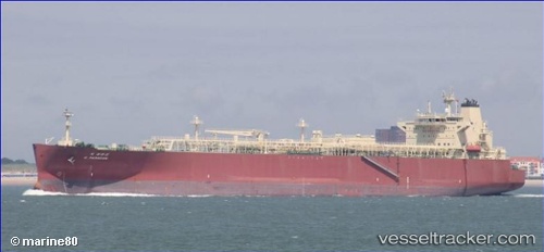
Vessel G.paragon IMO: 9656888, MMSI: 356117000 Lpg Tanker
UTC, 36.28694, 147.44052, course: 298, speed: 10.9
UTC, 36.43559, 147.02193, course: 300, speed: 10.7
2026-02-21 23:19:14 UTC, 36.53549, 146.72652, course: 295, speed: 11
Live AIS position:
UTC. 166 nm E of Santa Venera),
updated 2026-02-21 23:19:14 UTC.
Find the position of the vessel G.paragon on the map. The latter are known coordinates and path.
marine traffic ship tracker show on live map
The current position of vessel G.paragon is 36.53549 lat / 146.72652 lng. Updated: 2026-02-21 23:19:14 UTCCurrently sailing under the flag of Panama
Details:
Last coordinates of the vessel:
UTC, 36.13489, 147.82652, course: 310, speed: 9.6UTC, 36.28694, 147.44052, course: 298, speed: 10.9
UTC, 36.43559, 147.02193, course: 300, speed: 10.7
2026-02-21 23:19:14 UTC, 36.53549, 146.72652, course: 295, speed: 11