 vesseltracker.com
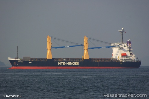
Vessel Mutsu IMO: 9355070, MMSI: 356376000 General Cargo Ship
UTC, 20.03152, 108.24083, course: 0, speed: 12.9
UTC, 20.31613, 108.23668, course: 2, speed: 13
2026-02-13 11:37:23 UTC, 20.73533, 108.31795, course: 29, speed: 13.4
Live AIS position:
UTC. 41 nm NW of Haikou New Pt),
updated 2026-02-13 11:37:23 UTC.
Find the position of the vessel Mutsu on the map. The latter are known coordinates and path.
marine traffic ship tracker show on live map
The current position of vessel Mutsu is 20.73533 lat / 108.31795 lng. Updated: 2026-02-13 11:37:23 UTCDetails:
Last coordinates of the vessel:
UTC, 19.45312, 108.24935, course: 3, speed: 12.4UTC, 20.03152, 108.24083, course: 0, speed: 12.9
UTC, 20.31613, 108.23668, course: 2, speed: 13
2026-02-13 11:37:23 UTC, 20.73533, 108.31795, course: 29, speed: 13.4