 vesseltracker.com
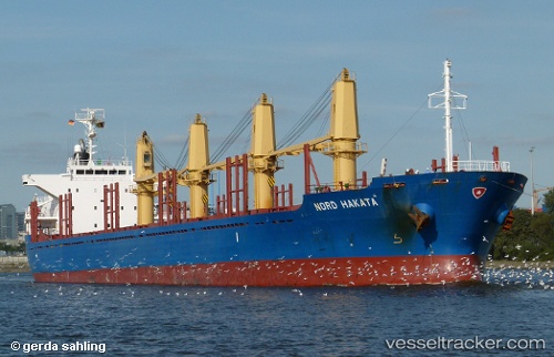
Vessel Nord Hakata IMO: 9550204, MMSI: 356490000 Bulk Carrier
UTC, 35.67020, 139.97961, course: 352, speed: 0
UTC, 35.67018, 139.97960, course: 352, speed: 0
2026-02-03 07:27:49 UTC, 35.67022, 139.97961, course: 352, speed: 0
Live AIS position:
UTC. Near Narashino),
updated 2026-02-03 07:27:49 UTC.
Find the position of the vessel Nord Hakata on the map. The latter are known coordinates and path.
marine traffic ship tracker show on live map
The current position of vessel Nord Hakata is 35.67022 lat / 139.97961 lng. Updated: 2026-02-03 07:27:49 UTCDetails:
Last coordinates of the vessel:
UTC, 35.56157, 139.98438, course: 331, speed: 0.2UTC, 35.67020, 139.97961, course: 352, speed: 0
UTC, 35.67018, 139.97960, course: 352, speed: 0
2026-02-03 07:27:49 UTC, 35.67022, 139.97961, course: 352, speed: 0