 vesseltracker.com
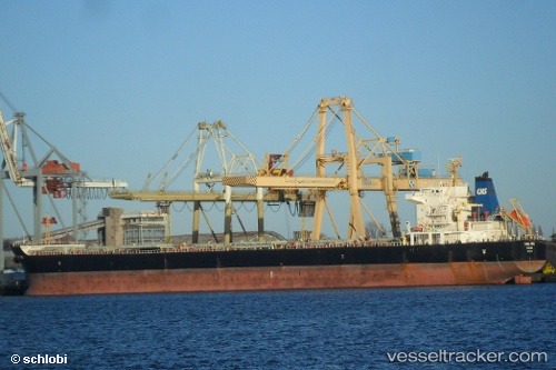
Vessel Hong Hing IMO: 9563615, MMSI: 356791000 Bulk Carrier
UTC, 31.10750, -60.22948, course: 302, speed: 6.1
UTC, 31.19333, -60.40667, course: -1, speed: 6
2026-02-03 11:30:14 UTC, 31.29500, -60.63500, course: -1, speed: 6
Live AIS position:
UTC. 217 nm E of Saint George),
updated 2026-02-03 11:30:14 UTC.
Find the position of the vessel Hong Hing on the map. The latter are known coordinates and path.
marine traffic ship tracker show on live map
The current position of vessel Hong Hing is 31.29500 lat / -60.63500 lng. Updated: 2026-02-03 11:30:14 UTCDetails:
Last coordinates of the vessel:
UTC, 31.00774, -60.02962, course: 300, speed: 6.7UTC, 31.10750, -60.22948, course: 302, speed: 6.1
UTC, 31.19333, -60.40667, course: -1, speed: 6
2026-02-03 11:30:14 UTC, 31.29500, -60.63500, course: -1, speed: 6