 vesseltracker.com
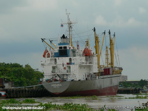
Vessel ANGARA IMO: 9136890, MMSI: 356889000 Reefer
UTC, 6.42833, 103.85167, course: -1, speed: 13
UTC, 5.82667, 103.95333, course: -1, speed: 13
2026-02-04 01:55:00 UTC, 5.44167, 104.01167, course: -1, speed: 13
Live AIS position:
UTC. 23 nm SW of Dulang Marine Terminal),
updated 2026-02-04 01:55:00 UTC.
Find the position of the vessel ANGARA on the map. The latter are known coordinates and path.
marine traffic ship tracker show on live map
The current position of vessel ANGARA is 5.44167 lat / 104.01167 lng. Updated: 2026-02-04 01:55:00 UTCCurrently sailing under the flag of Panama
ANGARA built in 1996 year
Deadweight:
4258 tDetails:
Last coordinates of the vessel:
UTC, 6.84128, 103.71561, course: 160, speed: 13.2UTC, 6.42833, 103.85167, course: -1, speed: 13
UTC, 5.82667, 103.95333, course: -1, speed: 13
2026-02-04 01:55:00 UTC, 5.44167, 104.01167, course: -1, speed: 13